Actually, this rain ‘is’ the parade. In parts of California, we do not get much of it, so when rain happens, it is worth celebrating. Although this side of the Santa Cruz Mountains gets significantly more rainfall than the chaparral on the other side in the Santa Clara Valley, there are not many more rainy days here. What that means is that when it rains here, it does so with more volume than in the Santa Clara Valley.
Rain is not easy to get pictures of. The first four picture just show water from one of our first major storms of the season. The fifth pictures does not even show that much. The sixth picture is from the most recent storm that came through Sunday night and finished on Monday morning.
1. This waterfall was flowing both through and over the deteriorated and also clogged gutter on the roof of the shop building across the driveway from the gardening shop at work. The gutter is so deteriorated that I would have expected all of the water to just flow through it. Incidentally, the big roll-up door to the lower left of the picture happens to be that of the plumbing shop.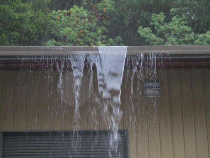
2. This waterfall was flowing through a storm drain on the Mount Hermon Road bridge over Zayante Creek, East Zayante Road, and the railroad tracks in between them.. This section of Mount Hermon Road is known to some as ‘the Bypass’ because it bypassed the older Conference Drive in picture #5. What is not visible in this picture is that the upper part of the waterfall lands in the ditch on the side of East Zayante Road below. It might have seemed like a good idea when the bridge was built, but so much water falls from so high up that it erodes the ditch, and splatters gravel onto cars driving by. The lower part of the waterfall flows into a ditch on the edge of the railroad tracks, and then under the tracks towards picture #3 below.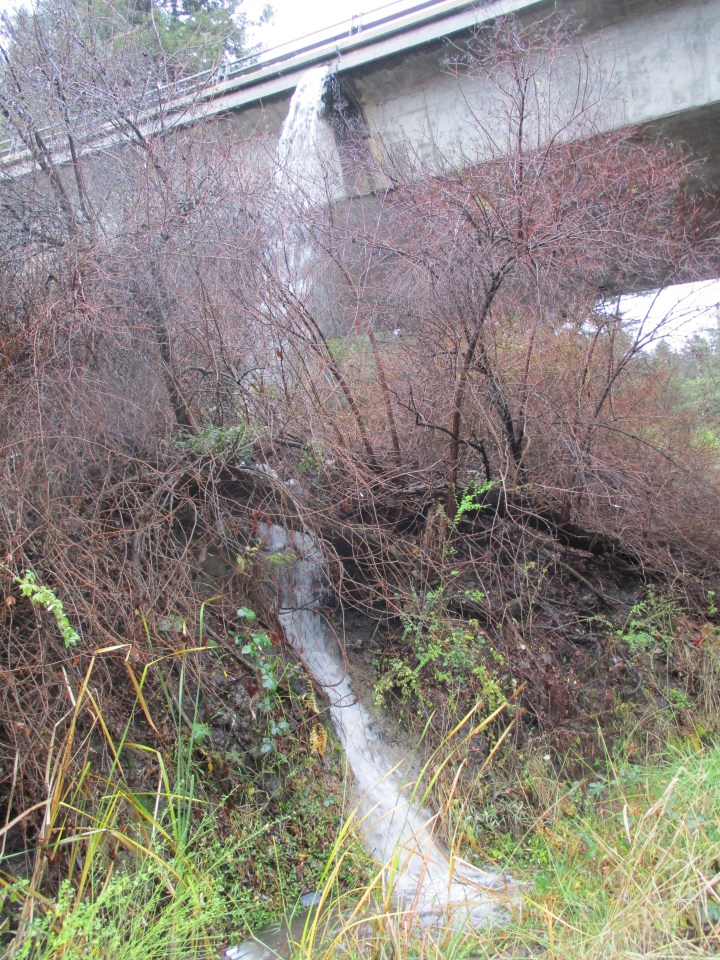
3. This waterfall was flowing out into Zayante Creek from a culvert just downhill from the culvert under the railroad tracks mentioned in #2 above. It is the same water that was falling from the Mount Hermon Road bridge.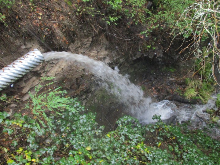
4. These two waterfalls were flowing from the roofs of the local supermarket and adjacent drug store and pharmacy, and onto the newsstand below. What is disturbing about this picture is these drains are merely back up drains that do not allow the flat roofs surrounded by parapet walls to fill with too much water if the main drains get clogged. The main drains are likely at the rear of the building where they can drain discretely and out of the way. These back up drains are on the front of the building so that they get noticed if they start to flow. All this water flowing out of them indicates that the main drains are clogged, and that the roofs are flooded.
5. This is the Conference Drive bridge over Zayante Creek, East Zayante Road, and the railroad tracks in between them. It is the bridge that was bypassed by the Mount Hermon Road bridge in picture #2. The big greenwaste pile where I dump debris from the landscapes is directly below the southern edge of this bridge, which is to the left in this picture. You can not see it in this picture that was taken before the rain started, but a bit of water drains from this bridge onto the greenwaste pile. It is not much, but it is enough to be a bother when I am unloading debris in the rain. It falls from so high up, that even if I am avoiding the spot where the falling water lands, the wind can blow it all over me. From that height, any bit of road gravel that falls with it can give me quite a sting.
6. The most recent storm finished early Monday morning, after dropping two and a half inches of rain.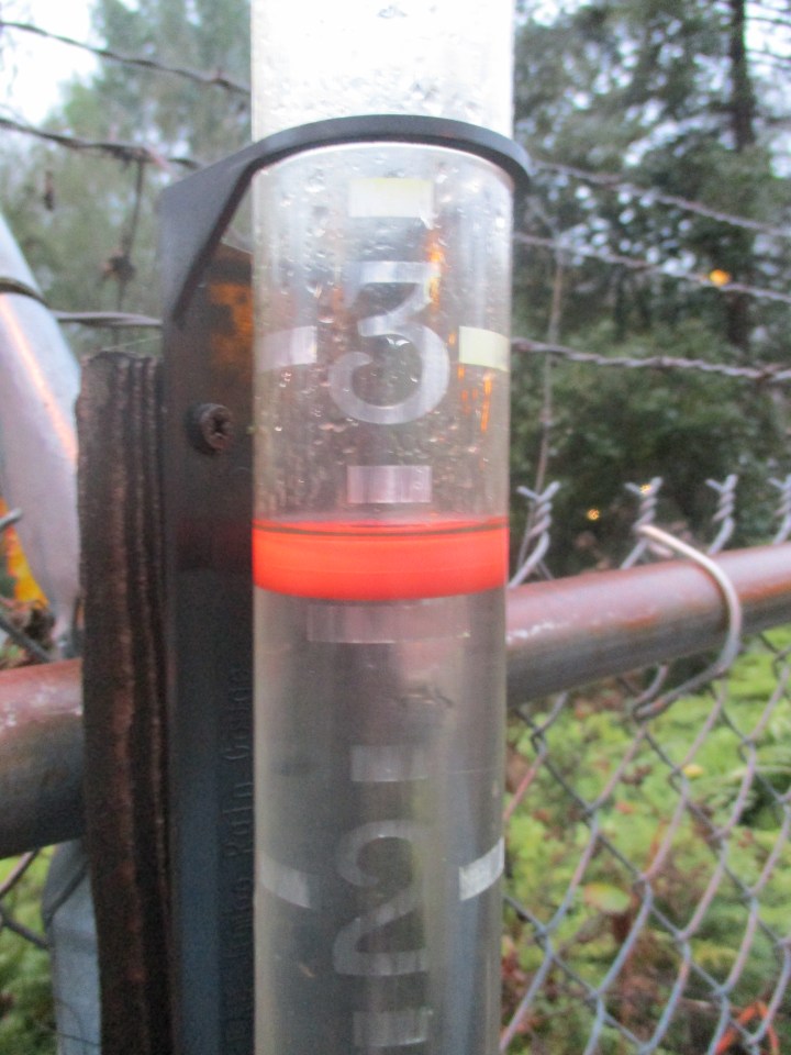
This is the link for Six on Saturday, for anyone else who would like to participate:
https://thepropagatorblog.wordpress.com/2017/09/18/six-on-saturday-a-participant-guide/